GIS (Geographic Information Systems)
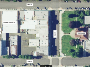
GIS (Geographic Information Systems) are computer-based tools used for mapping. These tools provide access to information for a wide variety of departments within the County. The GIS department maintains data for the county road system, school district boundaries, city limits, floodplains, and many others. The data within the GIS layers is continually growing as the user base grows and the need for additional information is identified.
Polk County is pleased to offer an interactive mapping tool, PCMAPS 5, which allows you to explore Polk County, Oregon with simple controls.
Polk County uses ESRI's GIS tools to manage and maintain our geographic information.
Polk County primarily uses Oregon State Plane North Projection for production of internal data. Data displayed on the web is commonly transformed to Web Mercator within the various applications.
GIS Data is available to the public in various formats. To download GIS data, please visit: Polk County GIS Data.
Interested in learning why Polk County uses GIS? Click for a brief Powerpoint presentation entitled: Is GIS an Expensive Luxury or a Way to Reduce the Cost of Doing Business?
Interested in more information on GIS technology? Visit the ESRI Blog!
Click any thumbnail image to view a slideshow


